Recreational Reefs
Torquay Artificial Reefs
In June 2015, purpose-built concrete reef modules were installed between Torquay and Breamlea and forms Victoria’s largest ever artificial reef.
In June 2015, purpose-built concrete reef modules were installed between Torquay and Breamlea and forms Victoria’s largest ever artificial reef. The reef consists of 25 modules arranged in 5 clusters on the seafloor. Each concrete module measures more than four metres high and weighs up to 20 tonnes. The site is in 25 metres of water and 3 kilometres offshore.
What makes this reef different is it designed to create variable water currents and upwellings that brings up nutrients to the surface. This process will attract baitfish, which in turn, will attract predatory recreational species such as kingfish. Each module will create a diverse and complex habitat as algae, sponges and invertebrates attach and colonise the surfaces.
The project was funded by $1,090,000 from recreational fishing licence fees and $410,000 from State Government Initiative funds in one of the biggest fish habitat enhancement projects in Victoria’s history.
The Torquay reefs are named “Rev’s Reef” after Trevor Buck who passed away in 2016. He was a VRFish Board member and outstanding advocate for recreational fishing, the environment and fish habitat.
| Torquay Reef Coordinates | ||
|---|---|---|
| 1 | 38˚ 19.828′ S | 144˚ 22.500′ E |
| 2 | 38˚ 19.942′ S | 144˚ 22.600′ E |
| 3 | 38˚ 20.184′ S | 144˚ 22.320′ E |
| 4 | 38˚ 20.065′ S | 144˚ 22.225′ E |
Port Phillip Bay Artificial Reefs
In May 2009, three artificial reefs were installed in a depth of 11 metres, approximately two kilometres off shore from Aspendale, Seaford and Frankston.
Aspendale (Rec Reef)
| Rec Reef Coordinates | ||
|---|---|---|
| 1 | 38˚ 02.152′ S | 145˚ 04.616′ E |
| 2 | 38˚ 02.168′ S | 145˚ 04.636′ E |
| 3 | 38˚ 02.184′ S | 145˚ 04.615′ E |
| 4 | 38˚ 02.167′ S | 145˚ 04.596′ E |
Seaford (Tedesco Reef)
| Tedsco Reef Coordinates | ||
|---|---|---|
| 1 | 38˚ 05.229′ S | 145˚ 05.954′ E |
| 2 | 38˚ 05.246′ S | 145˚ 05.974′ E |
| 3 | 38˚ 05.261′ S | 145˚ 05.953′ E |
| 4 | 38˚ 05.245′ S | 145˚ 05.934′ E |
Frankston (Yakka Reef)
| Yakka Reef Coordinates | ||
|---|---|---|
| 1 | 38˚ 08.467′ S | 145˚ 05.480′ E |
| 2 | 38˚ 08.483′ S | 145˚ 05.500′ E |
| 3 | 38˚ 08.499′ S | 145˚ 05.479′ E |
| 4 | 38˚ 08.482′ S | 145˚ 05.459′ E |
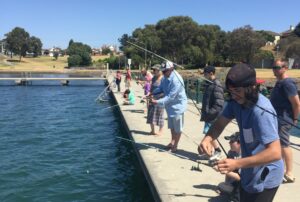
In 2012, after the success of the artificial reefs for boat-based recreational anglers, three new shore-based reefs were created in a water depth of approximately 3 – 4.5 metres.
Frankston Pier
Approximately 40 metres seaward of Frankston Pier.
Portarlington Pier
Approximately 40 to 70 metres seaward of Portarlington Pier’s rock-wall section.
Altona Pier
At the end of the Altona Pier.
East Gippsland Artificial Reefs
In 2014, eight new artificial recreational fishing reefs were established in East Gippsland. The reefs are spread across three major estuaries which are popular amongst anglers.
Gippsland Lakes Metung
| Metung Reef Coordinates | ||
| 1 | 37˚ 53.008’S | 147 ˚ 51.632’ E |
| 2 | 37˚ 53.112’S | 147 ˚ 51.629’E |
| 3 | 37 ˚ 53.133′ S | 147 ˚ 51.616′ E |
Nungurner
| Nungurner Reef Coordinates | ||
| 1 | 37˚ 53.112’S | 147 ˚ 53.404’ E |
| 2 | 37˚ 53.119’S | 147 ˚ 53.380’E |
| 3 | 37 ˚ 53.153′ S | 147 ˚ 53.370′ E |
Lake Tyers Mill Point
| Mill Point Reef Coordinates | ||
| 1 | 37˚ 50.080’S | 148 ˚ 04.802’ E |
| 2 | 37˚ 50.080’S | 148 ˚ 04.818’E |
| 3 | 37 ˚ 50.095′ S | 148 ˚ 04.809′ E |
Glass House
| Glass House Reef Coordinates | ||
| 1 | 37˚ 50.683’S | 148 ˚ 06.457’ E |
| 2 | 37˚ 50.695’S | 148 ˚ 06.449’E |
| 3 | 37 ˚ 50.706′ S | 148 ˚ 06.441′ E |
Bath House
| Bath House Reef Coordinates | ||
| 1 | 37˚ 50.545’S | 148 ˚ 05.517’ E |
| 2 | 37˚ 50.553’S | 148 ˚ 05.533’E |
| 3 | 37 ˚ 50.545′ S | 148 ˚ 05.548′ E |
Hendries
| Hendries Reef Coordinates | ||
| 1 | 37˚ 50.576’S | 148 ˚ 04.842’ E |
| 2 | 37˚ 50.577’S | 148 ˚ 04.861’E |
| 3 | 37 ˚ 50.509′ S | 148 ˚ 04.876′ E |
Mallacoota Inlet North Goodwin
| North Goodwin Reef Coordinates | ||
| 1 | 37˚ 31.169′ S | 149˚ 47.079′ E |
| 2 | 37˚ 31.193′ S | 149˚ 47.069 ‘ E |
| 3 | 37˚ 31.209′ S | 149˚ 47.050′ E |
| 4 | 37˚ 31.216′ S | 149˚ 47.076′ E |
South Goodwin
| South Goodwin Reef Coordinates | ||
| 1 | 37˚ 31.883’S | 149 ˚ 45.776’ E |
| 2 | 37˚ 31.894’S | 149 ˚ 45.796’E |
| 3 | 37 ˚ 31.896′ S | 149 ˚ 45.820′ E |
Geelong Rocky Recreational Reefs
In 2021, the construction of the rocky reefs in Corio Bay and the Geelong Arm was completed by the Victorian Fisheries Authority. The new recreational fishing reefs have been constructed at Outer Harbour, St Helens and Kirk Point.
St. Helens Reef will be called Merv’s Reef, named after the late Merv McGuire who was a former Executive Officer of VRFish. Kirk Point’s reef will be called Wilson Reef, named after Geelong fishing legend and writer Geoff Wilson.
| Merv’s Reef (St. Helens) | 38° 07.228’ | 144° 21.658’ |
| Moolap Reef (Outer Harbour) | 38° 06.374’ | 144° 28.581’ |
| Wilson’s Reef (Kirks Point) | 38° 03.436’ | 144° 36.588’ |


