April 4, 2022
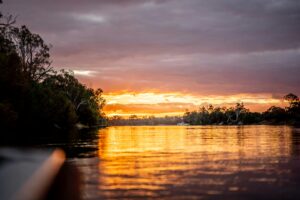
Beach Energy are currently undertaking an offshore drilling campaign in the Otway Offshore basin, near Port Campbell in south west Victoria.
Recently, they’ve observed recreational vessels entering the 500 metre Petroleum Safety Zone (PSZ) around the drill rig. It’s been a recurring issue throughout the drilling campaign. They have instructed a number of vessels to move on, and while some have responded by leaving the area, some vessels haven’t responded. Beach Energy have had to report the the incursions to Maritime Safety Victoria (MSV).
It serves as a timely reminder for recfishers who go fishing and boating in the area to follow the PSZ at all times to ensure your safety.
UPDATE FROM BEACH ENERGY | OTWAY PROJECT DRILLING CAMPAIGN
DRILLING ACTIVITY
The Ocean Onyx drill rig is currently drilling the Thylacine West-1 and Thylacine West-2 wells. Approximately late April 2022 the rig will move to its final drilling location at Thylacine North-2 well which will take between 70 to 90 days to complete, subject to weather. The location is approximately 68 km south of Port Campbell at the following coordinates.
| Latitude (S) | Longitude (E) |
39° 12.284’ | 142° 51.557’ |
SAFETY EXCLUSION ZONE
Beach Energy reminds mariners that vessels must not enter the 500 metre Petroleum Safety Zone (PSZ) around the drill rig. During drilling there is a further cautionary zone of 2 km radius around the rig’s mooring lines.
After drilling is complete, PSZs will remain in place at each well head. A further permanent PSZ will be created around new seabed infrastructure (see map in information sheet attached).
MOORING LINES AND ANCHORS
In preparation for drilling the final well in this campaign, approximately mid-to-late March 2022 mooring lines and anchors will be relocated from the Thylacine North-1 well to the Thylacine North-2 well.
The table below shows the coordinates for the existing mooring lines of the Thylacine North-1 well and the mooring lines for the Thylacine North-2 well, once they are in place.
THYLACINE NORTH-1 WELL
| Latitude (S) | Longitude (E) |
| 39° 13.299’ | 142° 52.629’ |
| 39° 13.182’ | 142° 52.629’ |
| 39° 13.621’ | 142° 52.464’ |
| 39° 13.095’ | 142° 52.625’ |
| 39° 13.776’ | 142° 52.344’ |
| 39° 13.868’ | 142° 52.070’ |
| 39° 13.411’ | 142° 52.497’ |
| 39° 13.980’ | 142° 52.314’ |
THYLACINE NORTH-2 WELL
| Latitude (S) | Longitude (E) |
| 39° 13.030’ | 142° 51.709’ |
| 39° 12.898’ | 142° 51.009’ |
| 39° 12.377’ | 142° 50.604’ |
| 39° 11.834’ | 142° 50.778’ |
| 39° 11.538’ | 142° 51.778’ |
| 39° 11.671’ | 142° 52.105’ |
| 39° 12.191’ | 142° 52.510’ |
| 39° 12.735’ | 142° 52.336’ |
FURTHER ACTIVITIES
In 2023, seabed infrastructure will be installed and well connection and commissioning activities will be undertaken. Further updates will be provided.
FURTHER INFORMATION
If you have any questions or require further information, please don’t hesitate to contact Beach Energy: [email protected] or 1800 797 011 or visit their website beachenergy.com.au.