October 1, 2025
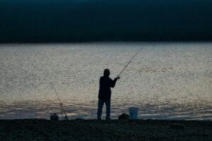
Inland freshwater anglers recognise the Goulburn River as home to a wide variety of both native and introduced fish species. Those keen on chasing iconic natives like Murray cod and golden perch will find the northern stretch downstream of Shepparton an outstanding spot to cast a line. Throughout the year, trout are regularly stocked, with large ex-broodstock trout often released between Eildon and Alexandra in preparation for the trout season.
To inform and improve water management in the waterway, the Commonwealth Environmental Water Holder run a science program called the Flow Monitoring, Evaluation and Research (also known as Flow-MER). The Flow-MER program works with scientists, water managers, First Nations and community to understand how aquatic ecosystems respond to water for the environment in the Murray-Darling Basin.
The findings of the program are used to inform the water management of the Goulburn River including the use of environmental water. Water for the environment is water that is set aside and used specifically to improve and maintain the health of rivers and wetlands, benefitting the plants and animals that depend on them.
Spring environmental water in the Goulburn River
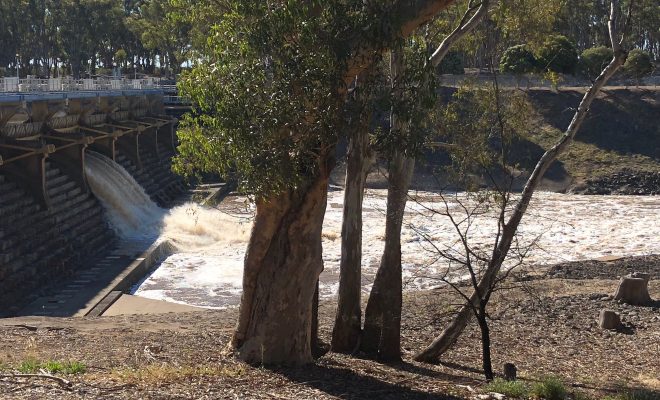
Through September and October, Goulburn Broken CMA have advised that water for the environment will be released into the Goulburn River, to stimulate fish movement and promote the growth of native plants to help protect the riverbank.
This annual water release, referred to as the Goulburn River spring fresh, will run from approximately 13th September to 12th October.
The environmental water will greatly benefit native vegetation by wetting the river’s banks and then receding, encouraging new growth. This water for the environment will also increase habitat and food resources for native fish such as Murray Cod, Trout Cod and Golden Perch, platypus and waterbugs.
The Goulburn River and Northern Victorian Tributaries
The Goulburn Rivers and Northern Victorian Tributaries (GRANT) Flow-MER program monitors and informs the delivery of water for the environment in the Goulburn, Broken, Campaspe and Loddon River systems and some Goulburn Broken catchment wetlands.
This area is on the lands of the Yorta Yorta and Taungurung people, Traditional Owners of the land and waters in the Goulburn and Broken catchments, and the Dja Dja Wurrung, Barapa Barapa and Wamba Wemba people, Traditional Owners of the land and waters in the Campaspe and Loddon catchments.
Over the past 9 years, the Flow-MER team have been monitoring and evaluating how environmental water is being used to support native fish so that they can breed, grow and move freely.
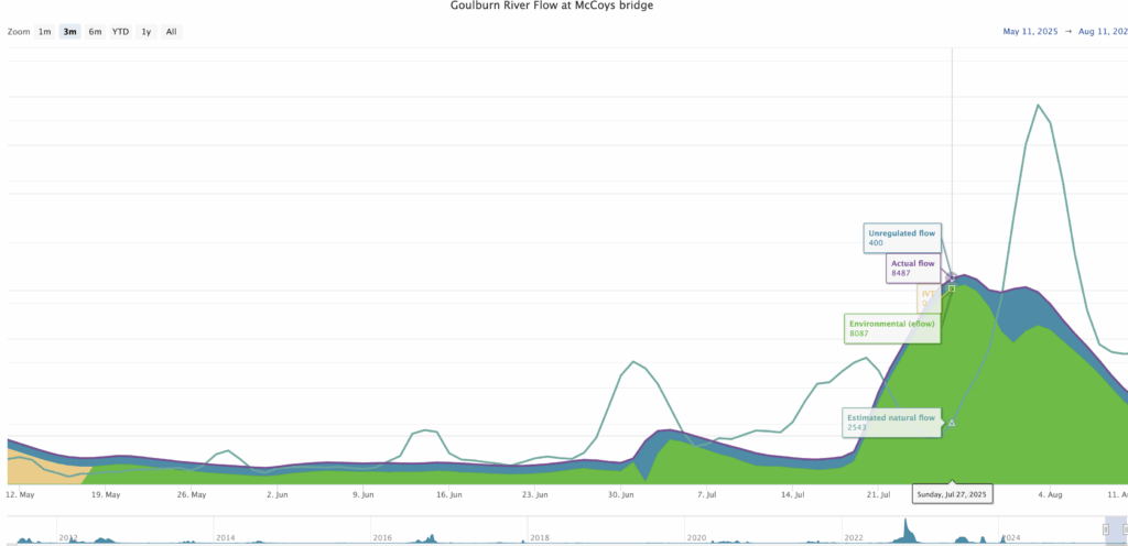
What’s Flowing in the Goulburn?
Recreational fishers often ask us about the flows in the Goulburn River as there can be a range of water flows through the river such as natural flows, inter-valley transfers (IVTs), and environmental water.
Now, there’s no need to wonder what’s flowing as the Goulburn Broken Catchment Management Authority have a hydrograph available online which shows the flows in the lower Goulburn River over time. The flows are measured at McCoy’s Bridge and it’s updated weekly.
A hydrograph is a graph which shows flows in a river over time, at a particular location. They are a useful tool used by agencies around the world to both plan river flows, and show how actual flows have occurred over time.
In the hydrograph, you can see whether flows in the river are operational flows, including inter-valley transfers (IVTs), or water for the environment. It also shows the probable flow without e-water flow or IVT, estimated natural flow and actual flow.
The Murray Darling Basin Authority also provide information about the water flows, levels, salinity, temperatures, and flow forecast on their River Data website.